Snow Depth
Snow Depth is a vital parameter in meteorology, hydrology, agriculture, and environmental monitoring. It refers to the vertical thickness or accumulation of snow on the ground, typically measured in centimeters or inches. Accurate Snow Depth data is essential for predicting water availability, managing winter road safety, planning ski operations, and studying climate patterns. From automated sensors to manual measuring tools, tracking Snow Depth is a key part of understanding winter weather and its broader environmental impact.


Snow Depth
USH-9 Snow Depth Sensor

Snow Depth
SPA-2 Snow Pack Analyser

Snow Depth
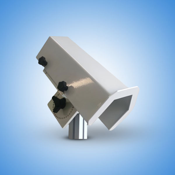
3S-SDS-MB Snow Depth Sensor
Snow Depth
SHM31 Lufft Snow Depth Sensor
Frequently Asked Questions
Snow Depth is the measurement of the thickness of snow that has accumulated on the ground. It includes all layers of snow that may have fallen over several days or weeks, and not just the most recent snowfall. Unlike snowfall rate (which measures how much snow falls in a certain time), Snow Depth shows how much snow is currently present.
This information helps in:
1. Forecasting floods during snowmelt seasons
2. Estimating water storage in snowpack
3. Managing snow removal and road safety
4. Planning winter sports and outdoor activities
Snow Depth can be measured manually or with automatic instruments, depending on the requirement and location.
1. Manual Measurement
A graduated snow depth stick or snow gauge is placed vertically into the snow to record the depth. This method is simple and cost-effective but not suitable for remote or continuous monitoring.
2. Ultrasonic Snow Depth Sensors
These are mounted above the ground and use sound waves to detect the distance between the sensor and the snow surface. The difference between the ground level and current surface gives the Snow Depth.
3. Laser or Radar-Based Sensors
Advanced sensors use laser or radar technology to measure snow accumulation with high accuracy, even in difficult weather conditions.
4. Satellite and Remote Sensing
Used for large-scale observations, especially in mountainous or inaccessible areas. Though not as precise as ground-based tools, these are helpful for regional snow cover estimates.
Monitoring Snow Depth is crucial for several reasons:
1. Water Resource Management
Snowpack acts as a natural reservoir. Knowing the Snow Depth helps estimate future water availability, especially in river basins and drought-prone areas.
2. Flood Risk Forecasting
Melting snow can lead to flooding. Monitoring Snow Depth allows early warnings and preventive actions.
3. Climate Change Studies
Changes in snowfall patterns and snow accumulation over time provide indicators of global warming and shifts in regional climates.
4. Transportation and Safety
Snow-covered roads are dangerous. Accurate Snow Depth data helps road maintenance teams respond effectively.
5. Agriculture and Forestry
Snow influences soil temperature and moisture levels. It affects planting schedules and forest health.
Snow Depth data is widely used in:
1. Weather Stations and Forecasting Models
2. Hydrological Modeling for Water Flow and Storage
3. Ski Resorts for Slope Conditions and Safety
4. Urban Snow Management and Emergency Services
5. Environmental Impact Assessments and Research Projects
Whether for public safety, scientific analysis, or commercial operations, Snow Depth data plays a critical role.
To monitor Snow Depth, various tools are employed depending on the site and precision required:
1. Snow Stakes and Rulers
2. Automatic Ultrasonic Snow Sensors
3. Ground-Based Laser Devices
4. Drones with Remote Sensing Equipment
5. Satellite Imagery Platforms
Modern systems are often integrated with data loggers and weather stations for real-time remote access.
1. Improved Weather Forecasting
2. Early Warning for Avalanches and Floods
3. Enhanced Water Resource Planning
4. Better Snow Removal Efficiency
5. Support for Research and Education
High-accuracy Snow Depth measurement allows decision-makers to act with confidence, reducing risks and improving planning.
To ensure accurate and reliable Snow Depth data:
1. Choose the Right Location – Avoid places near buildings or trees where snow accumulation might be uneven.
2. Calibrate Sensors Regularly – Ensure that automatic devices maintain accuracy over time.
3. Install Above Snowline – For ultrasonic or radar sensors, proper mounting height is critical.
4. Combine Manual and Automatic Methods – This enhances reliability through cross-verification.
